Who we serve
The Farm Community Fund focuses its resources in three areas:
Farms, land, and local food systems—initiatives that serve farms, protect land, or connect people to local food systems
Fitness and outdoor recreation—projects that cultivate or support active lifestyles
Community characteristics—projects that highlight an aspect of local heritage or culture
We serve community programs that advance our priorities and are working in targeted geographical areas in the Northeastern, Midatlantic, and Southeastern regions of the United States. In 2021 we will support programs in the geographic areas listed below.
The state maps below detailing the level of threat each of our funded regions is facing in losing agricultural land is provided by the American Farmland Trust (AFT). A new study from AFT entitled “Farms Under Threat: The State of the States” details the type and amount of land in the United States that is irreversibly lost to development each year, and the threat level in each state. Visit the American Farmland Trust Publications page to learn more. Additional resources including an interactive map of the United States is available through the Farmland Information Center.

“Saving the land that sustains us means focusing not just on maintaing and protecting the agricultural land base but on the management of that land, and on the farmers, ranchers, and landowners who work the land.”
— Chris Coffin, American Farmland Trust Senior Policy Advisor

Farm Community Fund benefits on-farm projects and community initiatives in and around Farm to Fork Fitness Adventures’ host communities with the support of the Farm to Fork Fitness community.
Visit our Ride with Us page to join one of these cycling or running events in 2021.
Learn how you can support projects in your area.
2021 Project Grant Geographic Areas

Highlighted areas indicate Farm to Fork Fitness Adventure host communities and Farm Community Fund geographic funding areas.

Connecticut
23,000 acres of agricultural land in Connecticut were converted between 2001 and 2016.
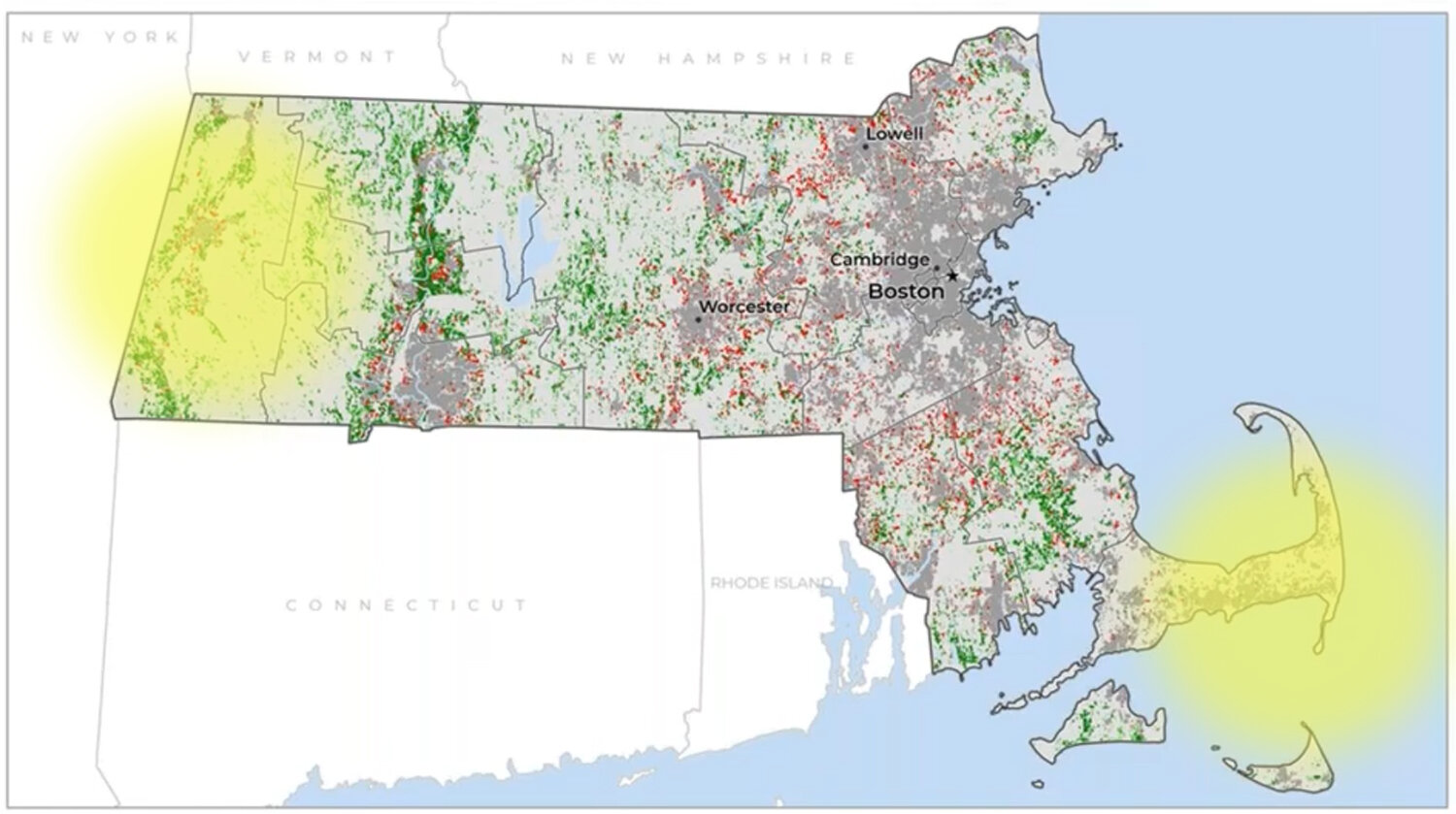
Massachusetts
27,200 acres of agricultural land in Massachusetts were converted between 2001 and 2016.

Maryland
102,700 acres of agricultural land in Maryland were converted between 2001 and 2016.


New Hampshire
11,600 acres of agricultural land in New Hampshire were converted between 2001 and 2016.

New Jersey
70,900 acres of agricultural land in New Jersey were converted between 2001 and 2016.

New York
253,500 acres of agricultural land in New York were converted between 2001 and 2016.

Pennsylvania
346,800 acres of agricultural land in Pennsylvania were converted between 2001 and 2016.

South Carolina
280,700 acres of agricultural land in South Carolina were converted between 2001 and 2016.

Virginia
339,800 acres of agricultural land in Virginia were converted between 2001 and 2016.
